
Explore
TravelTime solutions
TravelTime solutions
Helping you build
better location-based applications
Search and match
Match users to results using time and travel mode
Listing Filters
Max. travel time
01 hr 15 min
Preferred modes
Results
13 min commute
22 min commute
32 min commute
52 min commute
TravelTime API
51.59017, -0.01734
32 min
63.30705, -2.25976
60.37330, -0.4638
32 min
73.81656, -0.107481
52.2240, -35.6329
32 min
46.20396, -7.128321
46.20396, -7.12832
52 min
63.30705, -2.25976
Increase quality matches
Using straight-line distance at the core of your online marketplace leads to irrelevant, inaccurate matches.
TravelTime integrates time-based matching into the foundation of your algorithm—ensuring the right user connects with the right place at the right time.
This is not a surface-level UI filter. It's a fundamental shift that unlocks the hidden value straight-line geoqueries miss.
Benefits
Boost Search Relevancy and Conversions
Reduce Development Overheads
Unbeatable Scale and Performance
TravelTime APIs

Travel Time Matrix

Isochrone, H3 & Geohash

(Reverse) Geocoding
Spatial analysis
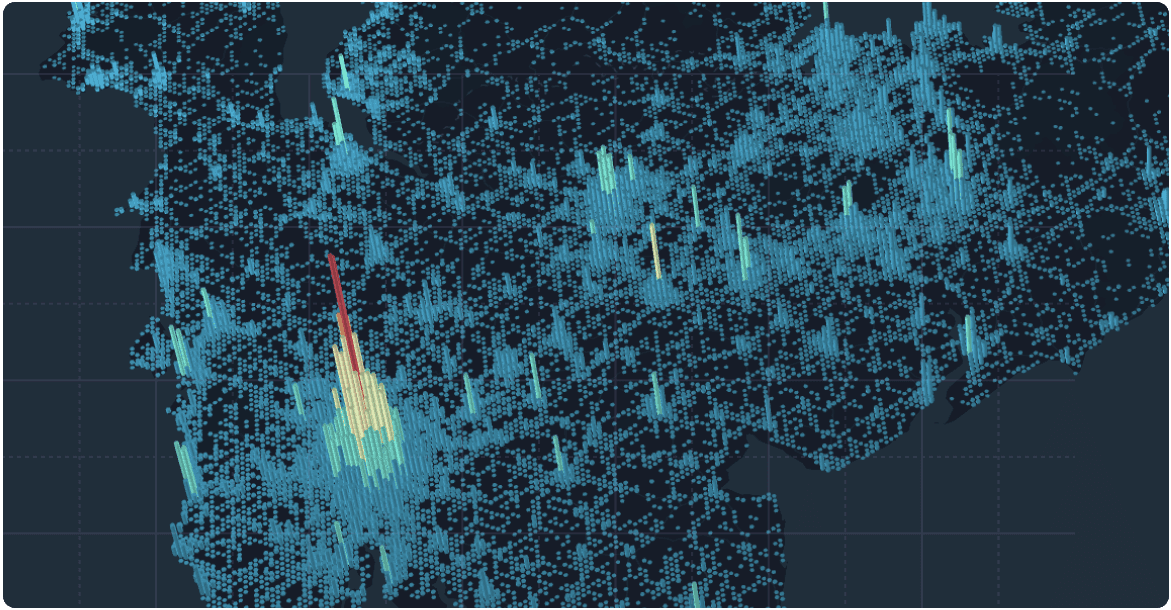
Analyse, visualise,
and innovate at scale
TravelTime API Request
{
  "resolution": 8,
  "properties": [
    "mean"
  ],
  "arrival_searches": [
    {
      "id": "arrival-search",
      "transportation": {
        "type": "public_transport"
      },
      "arrival_time": "2025-04-17T06:00:00.000Z",
      "coords": {
        "lat": 51.508037,
        "lng": -0.1280494
      },
      "travel_time": 3600
    }
  ]
}
TravelTime API Response
{
  "results": [
    {
      "search_id": "arrival-search",
      "cells": [
        {
          "id": "88195d3609fffff",
          "properties": {
            "mean": 3366
          }
        },
        {
          "id": "88195d3647fffff",
          "properties": {
            "mean": 3307
          }
        },
        {
          "id": "88195d360dfffff",
          "properties": {
            "mean": 3466
          }
        },
        {
          "id": "88195d3601fffff",
          "properties": {
            "mean": 3377
          }
        },
        {
          "id": "88195d360bfffff",
          "properties": {
            "mean": 3433
          }
        }
      ]
    }
  ]
}
Discover our unlimited usage model
Tap into TravelTime's global data sources—public transport networks, proprietary driving, cycling, and walking models, urban infrastructure data, historical movement patterns, and more, to perform location analysis at scale.
Our unlimited API usage model helps you analyse locations with confidence in your existing infrastructure.
Benefits
Unlimited Scale
uncover real-world proximity,
location trends, and
opportunities.
Data-Driven Decisions
demographic targeting, leverage precise time-based location intelligence.
Flexible and Customisable
TravelTime APIs

H3
Isochrone
Travel Time Matrix
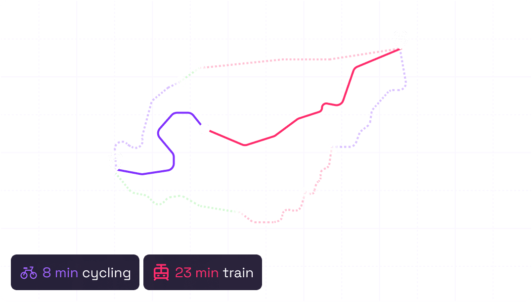
Routing
Build optimised and
accurate routing engines
TravelTime API
8 min
23 min
20 min
23 min
15 min
8 min
8 min
8 min
15 min
Your own compute and algorithms
Take control of route optimisation with unlimited accurate travel time calculations turn-by-turn directions, and multi-modal insights.
Stop fitting your unique routing challenges into someone else's solution. TravelTime allows you to build an advanced routing engine with your own compute and algorithms.
Never worry about restrictions to your API calls or number of requests with our unlimited usage model.
Benefits
Real-World Accuracy
for truly dependable routing engines.
Fast and Scalable
handles complex routing queries
at scale, from last-mile deliveries
to the travelling salesman
problem.
Custom Routing Logic
stop trips, and more.
TravelTime APIs

Routes
H3
Isochrone
Build better with TravelTime at your core
Let’s discuss your Search and Match, Spatial Analysis, and Routing needs.